In the District
The Flatiron District's revival has been shaped by a small number of committed institutions. Two worth knowing:
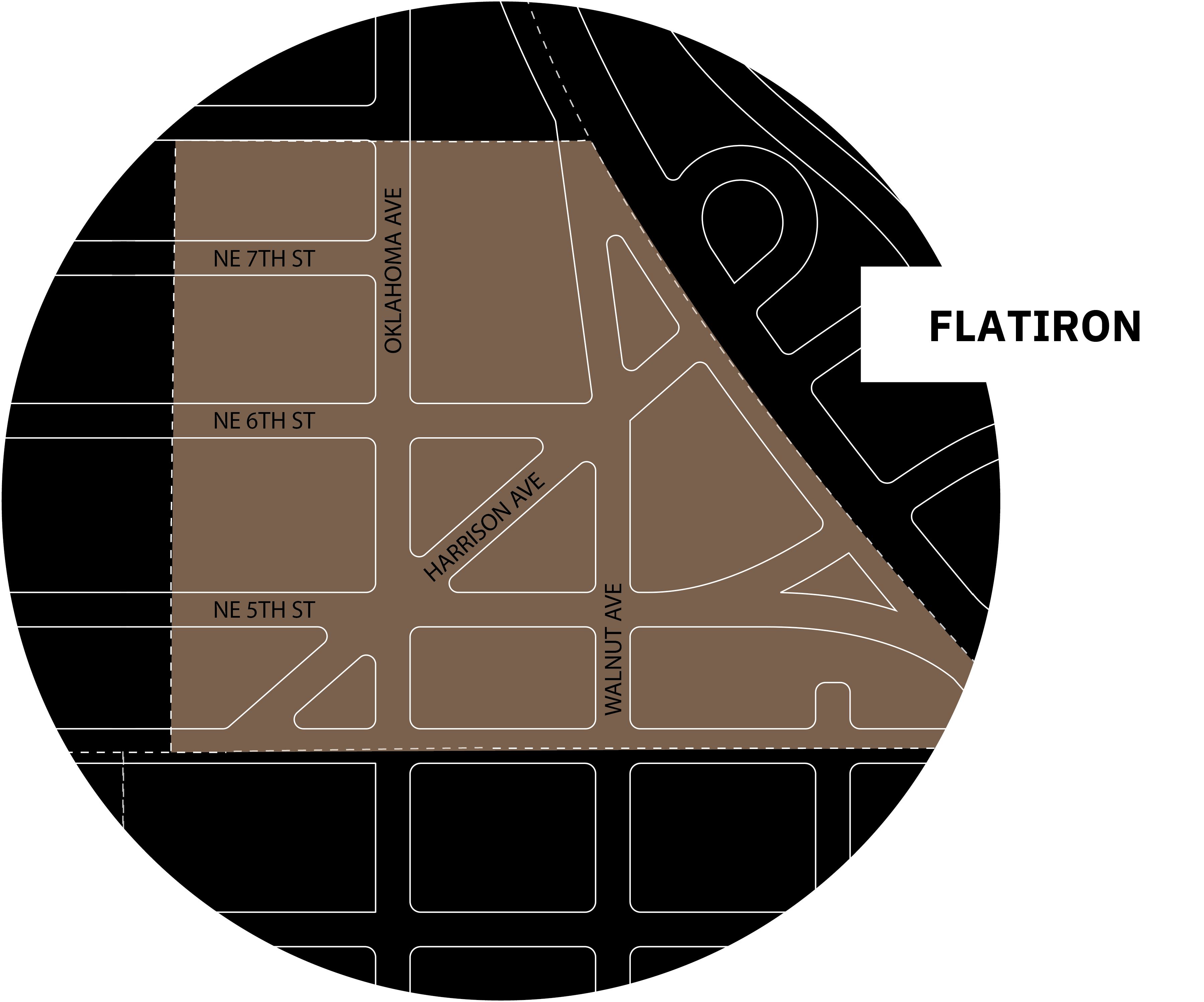
Oklahoma City's Flatiron District was born from geometry. When the city's early electric streetcar system cut a diagonal path through its orderly street grid, it created sharp triangular parcels at every intersection — and the buildings that filled those wedge-shaped lots took on the tapered, prow-like form that still defines the area today. The name "flatiron" traces to the cast-iron clothes iron of the 1700s, which shared that same triangular silhouette. New York's Flatiron Building made the shape internationally iconic in 1902. Oklahoma City's version came two decades later, shaped by trolley lines and the ambitions of a young city.
Those original streetcar tracks are still partially visible beneath the adjacent railroad overpass — a quiet, tangible link to the infrastructure that gave this district its identity.
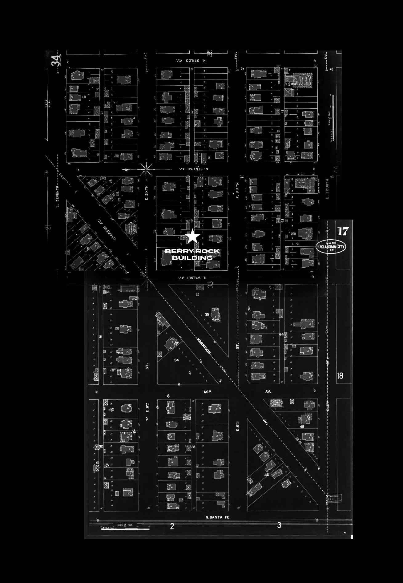
Sanborn fire insurance maps were drawn with obsessive precision — every building footprint, construction material, and utility alley documented for underwriters. This map shows the Flatiron District as it looked over a century ago: dense 25-foot-wide lots, connecting alleys, the diagonal streetcar lines already carving through the city's grid. The Berry Rock Building rises on this same ground.
The district reached its commercial height in the 1920s, anchored by a dense, walkable streetscape of German immigrant-owned businesses, dry goods stores, and neighborhood cafes. The heart of it was the Flatiron Gateway Building — designed by C.F. Meadors in 1924 as the Como Hotel, a blond-brick landmark at the convergence of NE 5th Street, Harrison Avenue, and North Oklahoma Avenue. It was the most visible marker at the northern gateway to downtown.
Like much of urban Oklahoma City, the district fell quiet in the mid-20th century. But where other historic neighborhoods were erased by Urban Renewal, the Flatiron's triangular buildings survived — preserving the architectural bones for what would eventually follow.
The turning point came when architect Rand Elliott and Lingo Construction transformed the long-vacant Como Hotel into PLICO at the Flatiron, a nationally award-winning renovation completed in 2016. It proved to Oklahoma City that this district was ready. Since then, the Flatiron has been steadily finding its footing as a connector — between downtown and the Innovation District, between the city's history and its next chapter.
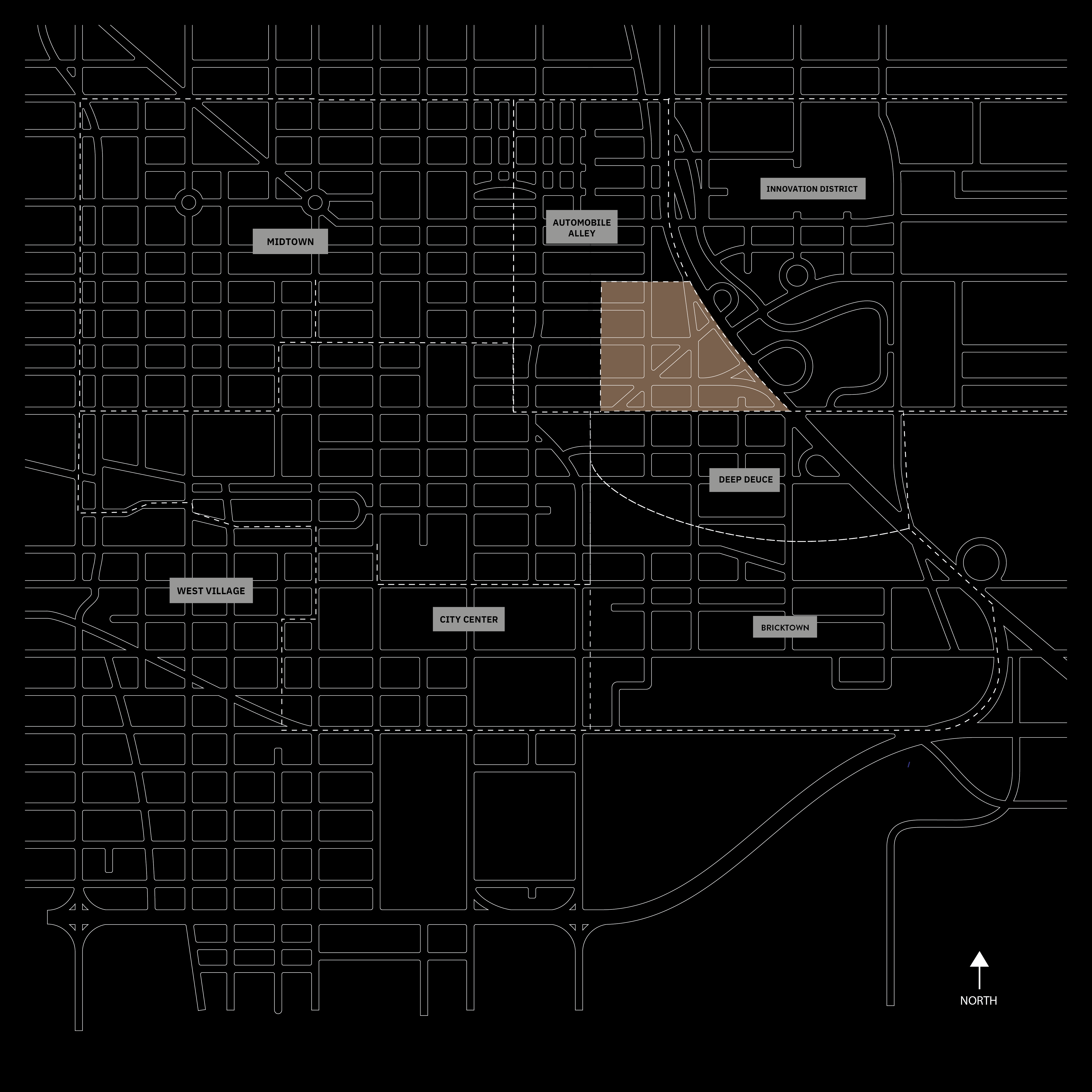
Today the district sits alongside Deep Deuce, Automobile Alley, and a 1.3-square-mile Innovation District reshaping OKC's northeast quadrant. The Oklahoma City Streetcar threads through it all.
The Berry Rock Building, rising at 616 N. Walnut Avenue, is the district's most significant new investment in decades.
The district's oldest surviving anchor has a story worth knowing. In 1912, August Heierding built his combined meat market and residence here — the structure erected by Ben Dancy, a man who served simultaneously as builder and county sheriff. The Heierding Building's specialized refrigeration system made it one of downtown Oklahoma City's earliest air-conditioned structures, a remarkable distinction for a city barely a generation old. The original owner carved the stone trim on its facade by hand.
The building's history has been pieced together across generations. A vintage pair of suspenders, recovered from a descendant of the Heierding family, now sits among a small collection of artifacts tied to the structure. A business card, found tucked inside the pocket of an old coat, surfaced as though left on purpose. These objects — alongside the flat iron tool itself, the cast-iron pressing iron of the 1700s whose triangular silhouette gave the district its name — are the kinds of tangible threads that make history feel less like record and more like memory.
After serving the Heierding family until 1960, the building endured abandonment and fire damage in 1987 before being acquired by John Bell, one of downtown's earliest preservationists. Listed on the National Register of Historic Places, it was substantially renovated by Rand Elliott Architects in 1995 — the same project that put Elliott's crew on scaffolding on the morning of April 19th, when the Oklahoma City bombing sent a pressure wave through this neighborhood. Workers witnessed the debris and felt the blast. A drive shaft from a truck pierced the wall of a neighboring building. The memory of that morning is woven into the fabric of this place and the people who chose to stay.
More on the building ↗The Flatiron District did not arrive at its current identity by accident. In the early 1990s, a proposed truck stop threatened to anchor the northern gateway to downtown in a very different direction. Proactive property acquisition blocked it. The district's survival as a place worth caring about has been, in many moments, a conscious decision made by specific people — not an outcome that history handed over willingly.
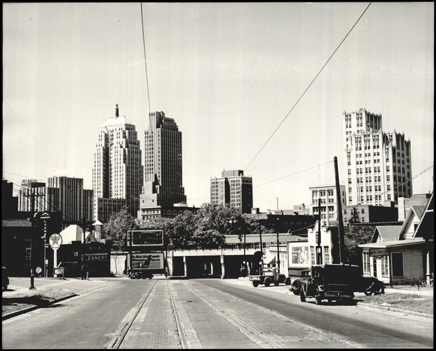
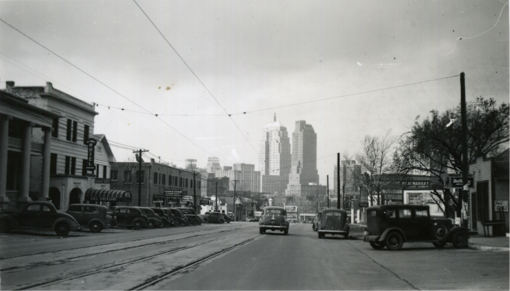
Urban renewal took its share. The construction of the downtown highway in the late 1960s and early 1970s required the demolition of scores of original buildings and wiped out entire blocks. Historical aerial photography and Sanborn fire insurance maps from the period document what was lost — plat surveys showing 25-foot-wide lots with connecting alleys for utilities, a compact urban fabric that largely disappeared. What remained in the Flatiron was preserved because the geometry of the district, shaped by its diagonal streets, made it difficult to absorb into the standard urban-renewal template.
The bones that survived have been tended carefully. Rand Elliott has spent decades managing and reinvesting in the district's properties — the Heierding Building, PLICO at the Flatiron — and working to establish the "Flatiron District" as a recognized, named destination with consistent presence on maps and platforms. The business improvement district, the street-level signage, the language used to describe this part of the city: none of it has been accidental.
The Flatiron District's revival has been shaped by a small number of committed institutions. Two worth knowing:
The nationally award-winning renovation of the 1924 Como Hotel, transformed by Rand Elliott Architects and Lingo Construction into a landmark that proved the district was ready for reinvestment.
VISIT WEBSITE ↗Rand Elliott Architects' own studio, designed by the firm and located within the district — a signal of long-term commitment to the neighborhood.
VISIT WEBSITE ↗Keeping a historic district alive requires more than individual buildings. In Automobile Alley, which borders the Flatiron to the west, coordinated neighborhood investment has resulted in the installation of 168 trees along the downtown entry corridor — a long-term commitment to pedestrian experience that has involved property owners, local stakeholders, and ongoing maintenance through collaboration. The work of planting a neighborhood, in the literal and figurative sense, happens incrementally and rarely makes headlines.
Looking ahead, the district is beginning to take its place in a changing skyline. A new glass arena is coming. The Innovation District continues to expand. And sitting at the district's eastern edge, elevated approximately 25 feet above the highway below, the Berry Rock Building will be visible from a distance that few buildings in this part of the city can claim.
That elevation is not incidental. It is a position — geographic and civic — that the district has been building toward for more than a century.